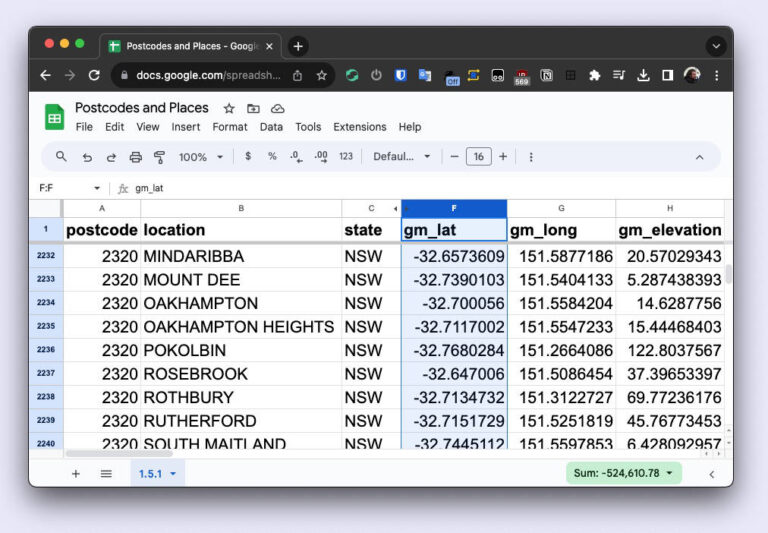
A Comprehensive and Accurate List of Australian Postcodes
(and much more)

australian postcode list spreadsheet
Until now it's been hard to find a list of Australian postcodes and suburbs.
There are a few lists out there, but as we found with our own projects they aren't accurate. All we wanted was a list of populated suburbs so we could allocate territories to distributors, but each list we examined (free and paid), had missing, additional, or incorrect suburbs. 

Our own need for accurate data led to the creation of this dataset.

Surprisingly there is no single authority for suburbs and postcodes, and different lists are used depending on whether you are sending mail, looking into electorates, or exploring demographics.

We've aggregated and autheticated data from 10+ sources to ensure a list that is both comprehensive and accurate - no suburbs or postcodes are missing, and no fake suburbs are included! If a place has a postcode and suburb name in an authorative source then we've included it. You can rest assured you'll have the most accurate list of postcodes in Australia.

Accurately sourced and sorted

We even include which of the major sources each entry appears in, so you can tell at a glance where the data comes from.

Always up to date

We're continually monitoring the source data for any changes. While the data doesn't change often, rest assured as soon as it does we jump into action to ensure you have the most accurate postcode list.

Flexible Formats

We've got you covered whether you are working in Microsoft Excel or Google Sheets, or need the data as a CSV, JSON, geoJSON, XML or SQL import. 

Australian suburb data is complex - we have suburbs with multiple postcodes, postcodes with multiple suburbs, postcodes which aren't suburbs, suburbs that span multiple local councils and elecorates etc...

When things get complex we choose accuracy.

As an example - when a suburb spans multiple local councils we'll provide you with a breakdown of the percentage that falls within each electorate. You won't find this data anywhere else!

postcode location lga lga_detailed
2321 CLIFTLEIGH Cessnock, Maitland [{
   "lga": "Cessnock",
   "lga_code": 11720,
   "lga_coverage": 74.40
},{
   "lga": "Maitland",
   "lga_code": 15050,
   "lga_coverage": 25.60
}]

It's complicated!
But we've made it as simple as possible.

All the fields!

Here is the current list of available fields.

We didn't stop at postcodes and suburbs, so whether you are divvying up sales territories, or want to map out population density across Australia, we've got you covered.

General

  • Postcode
  • Suburb
  • State
  • Area
  • Population (total, male/female)
  • Source
  • Australia Post category
  • Local Government Area
  • Statistical Areas

Geographic

  • Latitude
  • Longitude
  • Elevation
  • Google Place ID (with link)
  • GEOM data
  • full geoJSON format available

Electoral

  • State Electorate
  • Federal Electorate
  • (where suburbs span multiple elecorate both a list and breakdown of coverage is included)

Once-off Purchase

  • Instant access
  • Format of your choice
$59

Yearly Subscription

  • 1 year of updates
  • All formats
$89/yr

File Type Description
CSV Comma-Separated Values
XML Extensible Markup Language (nested)
XLSX Microsoft Excel Format
JSON List of JSON elements (nested)
geoJSON geoJSON file format - basically the same as the JSON version but made for mapping software. All localities are represented as POINTS.
SQL Text file containing INSERT statements for TABLE, COLUMNS and DATA.
Types used - VARCHAR, TEXT, NUMERIC, BIGINT, JSONB.
All columns are unconstrained.
Compatible with Postgres, SQL Server 2022, Azure...

Alternative column INSERT commands are also included for databases that aren't happy with the above types or lack of constraints:
Types used - VARCHAR, NUMERIC, BIGINT. All columns constrained to maximum size\/length occuring in the table.

If neither work for your specific database software then the CSV might be your best option.